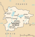
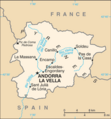
File:Andorra map - 2.png

Page contents not supported in other languages.
Dae Wikipedia, s'entziclopedia lìbera.

Andorra_map_-_2.png(325 × 347 pixels, mannesa de su file: 15 KB, tipu de MIME: image/png)

Custu documentu benit dae Wikimedia Commons e podet èssere impreadu in àteros progetos. A sighire est ammustrada sa descritzione in sa sua pàgina de descritzione de su documentu.

Ogetu

Descritzione
English: Map of Andorra
Italiano: Mappa di Andorra
Data
Mitza https://www.cia.gov/library/publications/the-world-factbook/maps/maptemplate_an.html
Autore Directorate of Intelligence, CIA

Litzèntzia

Public domain
This image is in the public domain because it contains materials that originally came from the United States Central Intelligence Agency's World Factbook.

Bahasa Indonesia  čeština  Deutsch  eesti  English  español  Esperanto  français  galego  hrvatski  italiano  Nederlands  norsk nynorsk  polski  português  sicilianu  slovenščina  suomi  Türkçe  Zazaki  беларуская (тарашкевіца)  македонски  русский  српски / srpski  українська  ქართული  বাংলা  தமிழ்  മലയാളം  한국어  日本語  中文  中文(简体)  中文(繁體)  العربية  +/−

Original upload log

Data/Ora Dimensiones Utente Cumentu
15 Martzu 2013, 16:06:12 328 × 353 (15867 bytes) Edoardo Cavaleri (cuntierra · cuntributos) {{Information |Description ={{en|1=Map of Andorra}} {{it|1=Mappa di Andorra}} |Source =https://www.cia.gov/library/publications/the-world-factbook/maps/maptemplate_an.html |Author =Directorate of Intelligence, CIA |Date =15...

Captions

Add a one-line explanation of what this file represents

Items portrayed in this file

depicts inglesu

MIME type inglesu

image/png

checksum inglesu

4d934f16a95ffed67a1aa7b0b41f32f89bbf8e5c

determination method inglesu: SHA-1 inglesu

data size inglesu

14,951 byte

height inglesu

347 pixel

width inglesu

325 pixel

Istòria de su file

Carca unu grupu data/ora pro castiare su file comente si presentada in su tempus indicadu.

Data/OraMiniaturaDimensionesUtenteCumentu
atuale09:45, 19 Fre 2022Miniatura de sa versione de is 09:45, 19 Fre 2022325 × 347 (15 KB)LojweCropped 1 % horizontally, 2 % vertically using CropTool with precise mode.
17:54, 16 Aus 2014Miniatura de sa versione de is 17:54, 16 Aus 2014328 × 353 (19 KB)GifTaggerBot: Converting file to superior PNG file. (Source: Andorra_map.gif). This GIF was problematic due to non-greyscale color table.

Sa pàgina chi sighit impreat custu documentu:

Impreu globale de su documentu

Impreu de custu documentu in àteras wikis:

Metadatos