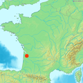
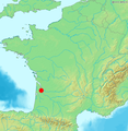
File:Bordeaux dot2.png
Bordeaux_dot2.png (567 × 568 pixels, mannesa de su file: 559 KB, tipu de MIME: image/png)
Istòria de su file
Carca unu grupu data/ora pro castiare su file comente si presentada in su tempus indicadu.
| Data/Ora | Miniatura | Dimensiones | Utente | Cumentu | |
|---|---|---|---|---|---|
| atuale | 11:11, 22 Mar 2006 |  | 567 × 568 (559 KB) | Frombenny~commonswiki | New version with indication that Corsica is not at its GPS location. |
| 15:21, 3 Mar 2006 |  | 567 × 568 (558 KB) | Piero Montesacro | Reverted to earlier revision | |
| 15:08, 3 Mar 2006 |  | 584 × 600 (484 KB) | Piero Montesacro | Reverted to earlier revision | |
| 23:39, 9 Fre 2006 |  | 567 × 568 (558 KB) | Frombenny~commonswiki | Map of France includes Corsica | |
| 13:03, 24 Ghe 2006 |  | 584 × 600 (484 KB) | Ludo33 | Locator map of Bordeaux, France |
Ligant a custu file
Sa pàgina chi sighit impreat custu documentu:
Impreu globale de su documentu
Impreu de custu documentu in àteras wikis:
- Impreu in arz.wikipedia.org
- Impreu in ast.wikipedia.org
- Impreu in ca.wikipedia.org
- Impreu in ceb.wikipedia.org
- Impreu in diq.wikipedia.org
- Impreu in eml.wikipedia.org
- Impreu in eu.wikipedia.org
- Impreu in fr.wikipedia.org
- Impreu in fr.wikinews.org
- Impreu in ga.wikipedia.org
- Impreu in gl.wikipedia.org
- Impreu in ha.wikipedia.org
- Impreu in ht.wikipedia.org
- Impreu in kab.wikipedia.org
- Impreu in la.wikipedia.org
- Impreu in la.wiktionary.org
- Impreu in mt.wikipedia.org
- Impreu in nds.wikipedia.org
- Impreu in nn.wikipedia.org
- Impreu in oc.wikipedia.org
- Impreu in ro.wikipedia.org
- Impreu in tl.wikipedia.org
- Impreu in tt.wikipedia.org
- Impreu in www.wikidata.org

