
File:Saskatchewan-map.png
Non si tenent risolutziones prus artas.
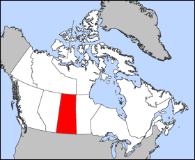
Saskatchewan-map.png (280 × 230 pixels, mannesa de su file: 15 KB, tipu de MIME: image/png)
Map of Saskatchewan
Projection: Lambert azimuthal equal-area
Geospatial data from: The Atlas of Canada, The National Atlas of the United States and U.S. Geological Survey
Cartographer: John Fowler
| I, the copyright holder of this work, release this work into the public domain. This applies worldwide. In some countries this may not be legally possible; if so: I grant anyone the right to use this work for any purpose, without any conditions, unless such conditions are required by law. |
Istòria de su file
Carca unu grupu data/ora pro castiare su file comente si presentada in su tempus indicadu.
| Data/Ora | Miniatura | Dimensiones | Utente | Cumentu | |
|---|---|---|---|---|---|
| atuale | 14:18, 24 Mar 2005 | | 280 × 230 (15 KB) | Voyager | Map of Saskatchewan Projection: Lambert azimuthal equal-area Geospatial data from: [http://atlas.gc.ca/ The Atlas of Canada], [http://www.nationalatlas.gov/ The National Atlas of the United States] and [http://www.usgs.gov U.S. Geological Survey] Carto |
Ligant a custu file
Sa pàgina chi sighit impreat custu documentu:
Impreu globale de su documentu
Impreu de custu documentu in àteras wikis:
- Impreu in bat-smg.wikipedia.org
- Impreu in br.wikipedia.org
- Impreu in en.wikipedia.org
- Impreu in en.wiktionary.org
- Impreu in eo.wikipedia.org
- Impreu in frr.wikipedia.org
- Impreu in gd.wikipedia.org
- Impreu in hu.wikipedia.org
- Impreu in hu.wiktionary.org
- Impreu in io.wikipedia.org
- Impreu in kw.wikipedia.org
- Impreu in lij.wikipedia.org
- Impreu in nn.wikipedia.org
- Impreu in pam.wikipedia.org
- Impreu in pms.wikipedia.org
- Impreu in sh.wikipedia.org
- Impreu in ta.wikipedia.org
- Impreu in uk.wikipedia.org
- Impreu in vo.wikipedia.org
- Impreu in wa.wikipedia.org
- Impreu in xmf.wikipedia.org
- Impreu in zh-min-nan.wikipedia.org