
File:Europe mediterranean 1190.jpg

Mannària de custa anteprima: 760 × 600 pixels. Àteras risolutziones: 304 × 240 pixels | 608 × 480 pixels | 973 × 768 pixels | 1,280 × 1,010 pixels | 2,293 × 1,810 pixels
Versione a risolutzione arta (2,293 × 1,810 pixels, mannesa de su file: 834 KB, tipu de MIME: image/jpeg)
Ogetu
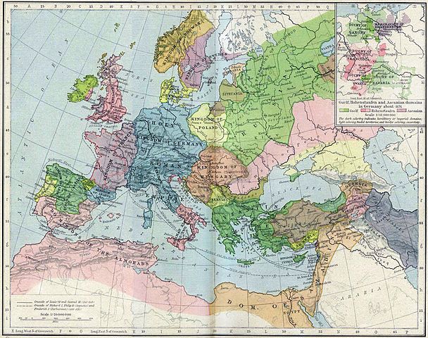
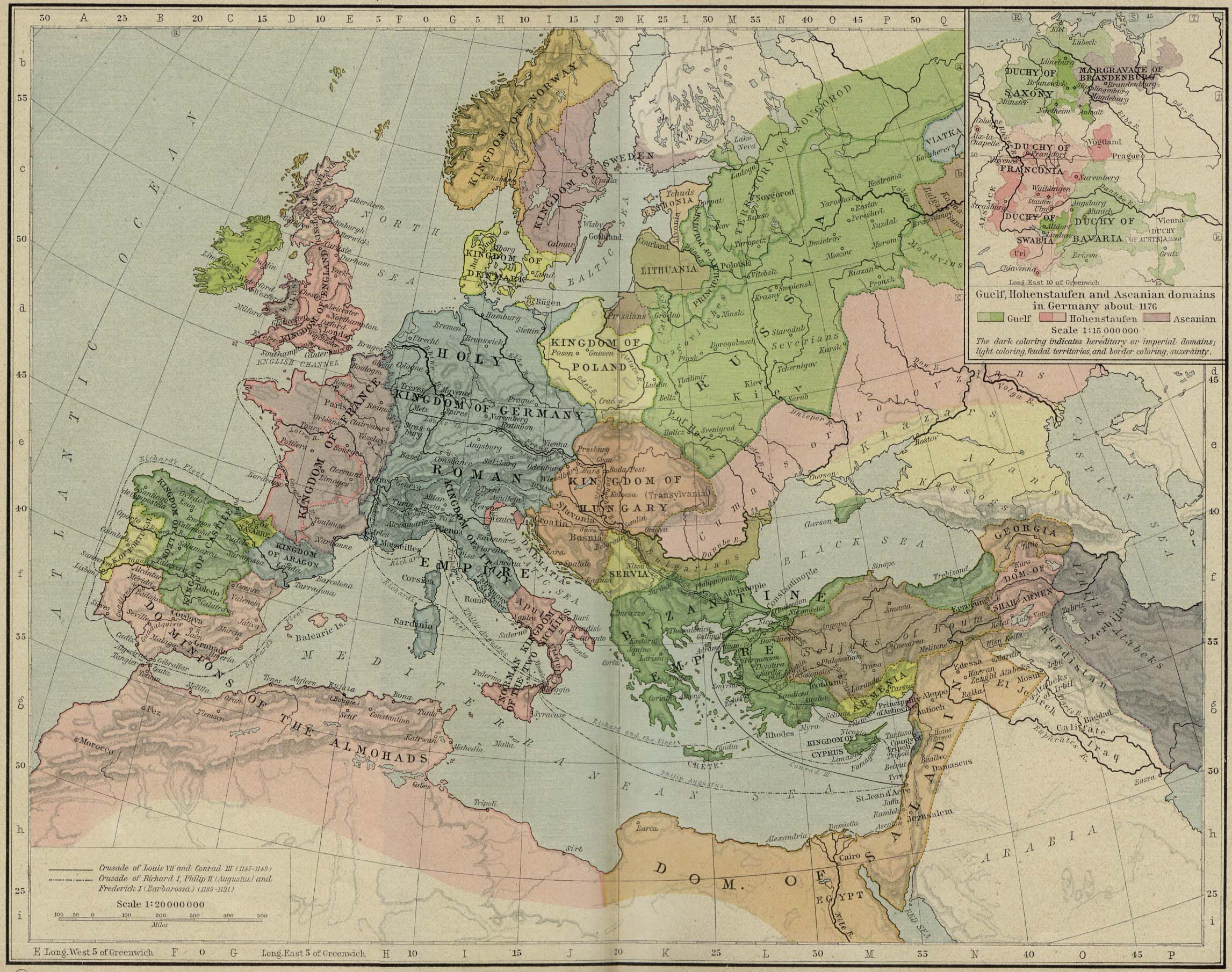
| Descritzione | Europa en 1190. |
| Data | |
| Mitza | Perry-Castañeda Library, Map Collection: From the "Historical Atlas" by William R. Shepherd, New York, Henry Holt and Company, 1923 |
| Autore | Roke |
| Àteras versiones | العربيَّة |
.jpg)
.jpg)
_en.png)
.png)
.jpg)
Litzèntzia
|
This work is in the public domain in its country of origin and other countries and areas where the copyright term is the author's life plus 70 years or fewer. This work is in the public domain in the United States because it was published (or registered with the U.S. Copyright Office) before January 1, 1929. | |
| This file has been identified as being free of known restrictions under copyright law, including all related and neighboring rights. | |
Istòria de su file
Carca unu grupu data/ora pro castiare su file comente si presentada in su tempus indicadu.
| Data/Ora | Miniatura | Dimensiones | Utente | Cumentu | |
|---|---|---|---|---|---|
| atuale | 17:46, 28 Maj 2011 | | 2,293 × 1,810 (834 KB) | Reddi~commonswiki | |
| 12:30, 8 Maj 2006 |  | 2,293 × 1,810 (667 KB) | Roke~commonswiki | Europe in 1190 {{Europe}} {{PD-PCL|http://www.lib.utexas.edu/maps/historical/shepherd/europe_mediterranean_1190.jpg}} Category: Historical maps of Europe |
Ligant a custu file
Sa pàgina chi sighit impreat custu documentu:
Impreu globale de su documentu
Impreu de custu documentu in àteras wikis:
- Impreu in azb.wikipedia.org
- Impreu in az.wikipedia.org
- Impreu in ca.wikipedia.org
- Impreu in cs.wikipedia.org
- Impreu in cy.wikipedia.org
- Impreu in da.wikipedia.org
- Impreu in de.wikipedia.org
- Impreu in el.wikipedia.org
- Impreu in en.wikipedia.org
- Impreu in en.wikibooks.org
- Impreu in eo.wikipedia.org
- Impreu in es.wikipedia.org
- Impreu in et.wikipedia.org
- Impreu in fa.wikipedia.org
Càstia àteros impreos globales de custu documentu.