
File:Kingdom of Sicily 1190.svg

Size of this PNG preview of this SVG file: 550 × 375 pixels. Àteras risolutziones: 320 × 218 pixels | 640 × 436 pixels | 1,024 × 698 pixels | 1,280 × 873 pixels | 2,560 × 1,745 pixels
Versione a risolutzione arta (file in formadu SVG, mannesa nominale 550 × 375 pixel, mannesa de su file: 998 KB)
Ogetu
This W3C-unspecified vector image was created with Inkscape .


.svg)
.svg)
.svg)
.svg)
.svg)


.svg)
.svg)
.svg)


.png)
.png)


.svg)


.svg)

.svg)


.svg)
.svg)
.svg)
.svg)


.svg)
.png)


.svg)


.svg)
.svg)


.svg)


.svg)


.svg)
.svg)
.svg)
.svg)
.svg)
.svg)
.svg)
_cropped.svg)
.svg)
.svg)
.svg)
.svg)
.svg)
.svg)
.svg)
.svg)
.svg)
.svg)
.svg)
.svg)
.svg)
.svg)
.svg)
.svg)
.svg)
.svg)
.svg)
.svg)
.svg)
.svg)
.svg)
.svg)
.svg)
.svg)
.svg)
.svg)
.svg)
.svg)
.svg)
.svg)
.svg)
.svg)
.svg)
.svg)
.svg)
.svg)
.svg)
.svg)
.svg)
.svg)
.svg)
.svg)
.svg)
Litzèntzia
This file is licensed under the Creative Commons Attribution-Share Alike 4.0 International license.
- Tue ses lìberu:
- de cundivìder – de copiare, ispainare e trasmìtere s'òpera
- de adatare – de adatare s'òpera
- Suta de sas cunditziones chi sighint:
- atributzione – Depes indicare s'autore comente si tocat, frunire unu ligàmene a sa litzèntzia e indicare si sunt istadas fatas modìficas. Lu podes fàghere in cale si siat manera chi tèngiat sensu, ma no in cale si siat manera chi diat s'idea chi su titulare de sa litzèntzia suportet a tie o a s'impreu tuo.
- cumpartzi a sa pròpria manera – Si modìficas, trasformas, o isvilupas su materiale as a dèpere distribuire sos contributos tuos suta de sa matessi litzèntzia de s'originale o una cumpatìbile.
Istòria de su file
Carca unu grupu data/ora pro castiare su file comente si presentada in su tempus indicadu.
| Data/Ora | Miniatura | Dimensiones | Utente | Cumentu | |
|---|---|---|---|---|---|
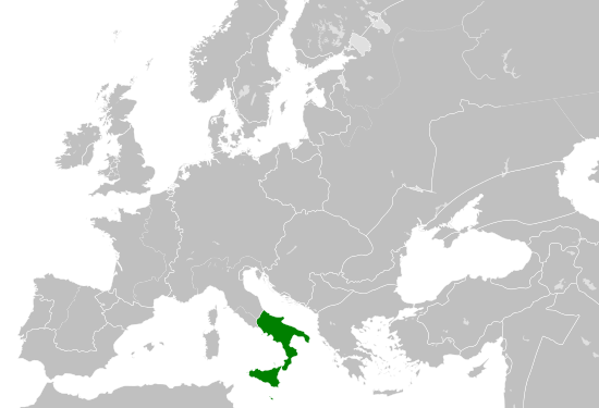
| atuale | 17:58, 29 Maj 2016 | | 550 × 375 (998 KB) | Alphathon | == {{int:filedesc}} == {{Inkscape}} {{Information |Description={{en|A map of the Norman en:Kingdom of Sicily within Europe circa 1190 CE. Note that the borders of the Cumans, Kipchaks, Kievan Rus', Kama Bulgarians and Viatka do not extend r... |
Ligant a custu file
Sa pàgina chi sighit impreat custu documentu:
Impreu globale de su documentu
Impreu de custu documentu in àteras wikis:
- Impreu in arz.wikipedia.org
- Impreu in ast.wikipedia.org
- Impreu in ca.wikipedia.org
- Impreu in cs.wikipedia.org
- Impreu in en.wikipedia.org
- Impreu in eo.wikipedia.org
- Impreu in es.wikipedia.org
- Impreu in gl.wikipedia.org
- Impreu in he.wikipedia.org
- Impreu in it.wikipedia.org
- Impreu in ja.wikipedia.org
- Impreu in ko.wikipedia.org
- Impreu in la.wikipedia.org
- Impreu in lv.wikipedia.org
- Impreu in mk.wikipedia.org
- Impreu in pl.wikipedia.org
- Impreu in ro.wikipedia.org
- Impreu in simple.wikipedia.org
- Impreu in sq.wikipedia.org
- Impreu in th.wikipedia.org
- Impreu in uk.wikipedia.org
- Impreu in vi.wikipedia.org
- Impreu in www.wikidata.org