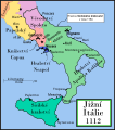
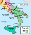
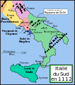
File:Southern Italy 1112.svg

Page contents not supported in other languages.
Dae Wikipedia, s'entziclopedia lìbera.

Versione a risolutzione arta(file in formadu SVG, mannesa nominale 712 × 807 pixel, mannesa de su file: 652 KB)

Custu documentu benit dae Wikimedia Commons e podet èssere impreadu in àteros progetos. A sighire est ammustrada sa descritzione in sa sua pàgina de descritzione de su documentu.

Ogetu

Descritzione
English: This is a political map of southern Italy in 1112 AD, the date when Roger II of Sicily reached his age of majority, also showing the border of the Kingdom of Sicily in 1154, on his death.

"The rarity of surviving records makes it impossible to draw a map of comital [counts'] responsibiities in southern Italy at the beginning of the twelth century." Matthew, p. 23.

As noted by Matthew, the political situation in southern Italy is much more complex than this map shows. There were numerous counts and semi-independent cities throughout the region. Moreover, the near-constant rebellions and conquests continually re-arranged the map.
Data
Mitza Traballu pròpriu
Autore MapMaster
Àteras versiones

[càmbia]

References

  • Bjorklund, Oddvar; Holmboe, Haakon; Rohr, Anders (1970) Historical Atlas of the World, Barnes & Noble, NY, SBN: 389-00253-4.
  • Houben, Hubert (translated by Graham A. Loud and Diane Milburn), (2002) Roger II of Sicily: Ruler between East and West, Cambridge University Press.
  • Konstam, Angus (2000) Atlas of Medieval Europe, Checkmark Books, New York.
  • Matthew, Donald (1992) The Norman Kingdom of Sicily Cambridge Medieval Textbooks.

Litzèntzia

I, the copyright holder of this work, hereby publish it under the following license:
GNU head Est permìtidu copiare, ispainare e/o modificare custu documentu sighende sas cunditziones de sa GNU Free Documentation License, Versione 1.2 o cale si siat versione prus noa publicada dae sa Free Software Foundation; chene peruna setzione fissa, perunu testu de cobertedda e perunu testu de palas. Una còpia de sa litzèntzia est inclùdida in sa setzione titulada GNU Free Documentation License.
w:en:Creative Commons
atributzione cumpartzi a sa pròpria manera
Custu documentu est litzentziadu in base a is tèrmines de sa litzèntzia Creative Commons Atributzione-Cumpartzi a sa pròpria manera 3.0 Unported.
Tue ses lìberu:
  • de cundivìder – de copiare, ispainare e trasmìtere s'òpera
  • de adatare – de adatare s'òpera
Suta de sas cunditziones chi sighint:
  • atributzione – Depes indicare s'autore comente si tocat, frunire unu ligàmene a sa litzèntzia e indicare si sunt istadas fatas modìficas. Lu podes fàghere in cale si siat manera chi tèngiat sensu, ma no in cale si siat manera chi diat s'idea chi su titulare de sa litzèntzia suportet a tie o a s'impreu tuo.
  • cumpartzi a sa pròpria manera – Si modìficas, trasformas, o isvilupas su materiale as a dèpere distribuire sos contributos tuos suta de sa matessi litzèntzia de s'originale o una cumpatìbile.
This licensing tag was added to this file as part of the GFDL licensing update.

Captions

Add a one-line explanation of what this file represents

Items portrayed in this file

depicts inglesu

copyrighted inglesu

Istòria de su file

Carca unu grupu data/ora pro castiare su file comente si presentada in su tempus indicadu.

Data/OraMiniaturaDimensionesUtenteCumentu
atuale19:29, 9 Ghe 2008Miniatura de sa versione de is 19:29, 9 Ghe 2008712 × 807 (652 KB)Salli~commonswiki
23:12, 16 Abr 2007Miniatura de sa versione de is 23:12, 16 Abr 2007712 × 807 (739 KB)MapMasterSlightly modified version
18:32, 20 Nad 2006Miniatura de sa versione de is 18:32, 20 Nad 2006712 × 807 (739 KB)MapMasterFixed typo, added Taranto
16:15, 16 Nad 2006Miniatura de sa versione de is 16:15, 16 Nad 2006712 × 807 (729 KB)MapMasterA political map of southern Italy in 1112 AD/CE, the date when Roger II of Sicily reached his age of majority.

Sa pàgina chi sighit impreat custu documentu:

Impreu globale de su documentu

Impreu de custu documentu in àteras wikis:

Càstia àteros impreos globales de custu documentu.