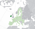
File:Location Ireland EU Europe.png

Mannària de custa anteprima: 721 × 600 pixels. Àteras risolutziones: 289 × 240 pixels | 577 × 480 pixels | 923 × 768 pixels | 1,231 × 1,024 pixels | 2,056 × 1,710 pixels
Versione a risolutzione arta (2,056 × 1,710 pixels, mannesa de su file: 176 KB, tipu de MIME: image/png)
Istòria de su file
Carca unu grupu data/ora pro castiare su file comente si presentada in su tempus indicadu.
| Data/Ora | Miniatura | Dimensiones | Utente | Cumentu | |
|---|---|---|---|---|---|
| atuale | 03:08, 18 Làm 2007 |  | 2,056 × 1,710 (176 KB) | Quizimodo~commonswiki | image (updated) |
| 12:44, 17 Làm 2007 |  | 2,056 × 1,710 (227 KB) | Quizimodo~commonswiki | {{Information |Description=Location map: (Republic of) Ireland (dark green) / European Union (light green) / Europe (dark grey); inspired by and consistent with general country locator maps by User:Vardion, et al |Source=self-made |Date= |Author= [[User:Q |
Ligant a custu file
Sa pàgina chi sighit impreat custu documentu:
Impreu globale de su documentu
Impreu de custu documentu in àteras wikis:
- Impreu in an.wikipedia.org
- Impreu in be-tarask.wikipedia.org
- Impreu in chr.wikipedia.org
- Impreu in gan.wikipedia.org
- Impreu in haw.wikipedia.org
- Impreu in hif.wikipedia.org
- Impreu in incubator.wikimedia.org
- Impreu in ka.wikipedia.org
- Impreu in krc.wikipedia.org
- Impreu in lad.wikipedia.org
- Impreu in lv.wikipedia.org
- Impreu in ml.wikipedia.org
- Impreu in mzn.wikipedia.org
- Impreu in pl.wikivoyage.org
- Impreu in qu.wikipedia.org
- Impreu in sah.wikipedia.org
- Impreu in tl.wikipedia.org
- Impreu in tpi.wikipedia.org
- Impreu in ug.wikipedia.org
- Impreu in yi.wikipedia.org


